
Derecho Storm Threatens Northern Plains with 90 mph Winds and Severe Damage Risks
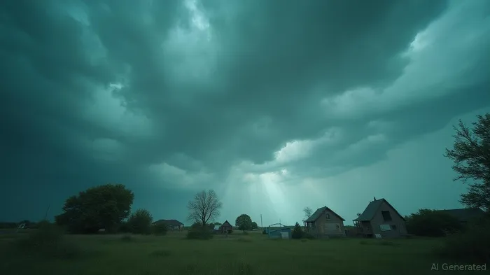
Forecasters are warning of the potential formation of a rare and severe weather event, known as a derecho, across parts of the United States. The Northern Plains are set to experience damaging and possibly destructive thunderstorms fueled by intense July heat and humidity. There is increasing concern among meteorologists that these storms could evolve into a derecho, which is characterized by long-lasting lines of storms delivering powerful, damaging wind gusts over several hundred miles. Derecho events are relatively uncommon, typically occurring once or twice a year in the U.S. during summer months, particularly across the Midwest and the Mississippi-Ohio Valley corridor.
The Storm Prediction Center has declared a Level 4 out of 5 risk of severe thunderstorms affecting parts of South Dakota, Minnesota, and Iowa on Monday. This elevated risk level is predominantly due to the possibility of wind gusts reaching up to 90 mph, which are comparable to those in a Category 1 hurricane that has sustained winds of at least 74 mph and stronger gusts. In addition to strong winds, a few tornadoes could form within the line of already dangerous storms.
Adjacent areas, including parts of North Dakota, South Dakota, Nebraska, Minnesota, and Iowa, are under a Level 3 out of 5 risk of severe thunderstorms. These regions are also facing threats of damaging wind gusts, hail, and possible tornadoes. A broader Level 2 out of 5 risk encompasses much of the Northern Plains and sections of the Midwest, with the primary danger being the damaging wind. However, isolated tornadoes or large hail are potential risks that cannot be entirely dismissed.
On Monday morning, severe thunderstorms swept through parts of North Dakota, bringing gusts of up to 76 mph. As the morning progressed, storm systems began to redevelop near the border of Montana and the Dakotas, advancing into the region by the afternoon. With abundant heat and humidity available, these storms are expected to intensify substantially.
Analysts predict that the prospective derecho could reach its peak strength in the late afternoon or early evening in eastern South Dakota or southern Minnesota before proceeding to Iowa. The storms are anticipated to gradually lose strength overnight as they move towards the Great Lakes. The recent storm activity is the latest in a series of severe weather events to impact the Northern Plains.
Over the preceding weekend, severe storms including tornadoes traversed the region, generating numerous reports of wind and hail across eastern South Dakota, southern Minnesota, and northern Iowa. Among the incidents, three tornadoes were reported in rural areas. Golf ball-sized hail, downed trees, and flash flooding were noted in the Minneapolis-St. Paul area of Minnesota.
The weekend's rainfall has saturated the soil, heightening the risk of flash floods in the Northern Plains, especially in low-lying and urban zones. The Weather Prediction Center has delineated a Level 2 of 4 risk for flooding rain across the region.
The threat of severe storms diminishes Tuesday, transitioning into a Level 1 of 5 risk as adverse weather moves south and east into the Central Plains and Great Lakes. However, these storms could still bring another chance for flooding to the Central Plains. As of late, thunderstorms risk levels for the Sioux Empire have been raised from enhanced to moderate, with expectations of severe weather extending into the early hours following Monday.
Forecasts emphasize the likelihood of a vigorous and enduring line of severe thunderstorms—called a derecho—traversing the Northern Plains on Monday. The event's projected impact includes significant damage to trees and structures, along with widespread power outages. Winds along this storm's path are expected to reach hurricane force, creating a substantial risk to property and safety.
Individuals residing in affected areas are urged to take precautions in advance of the event by securing shelter and ensuring they have multiple means of receiving National Weather Service warnings, such as by smartphone or NOAA weather radio. As this severe weather scenario develops, staying informed and prepared is essential for minimizing risks and ensuring safety.
Stay ahead of the market.
Get curated U.S. market news, insights and key dates delivered to your inbox.


AInvest
PRO
AInvest
PRO
Comments
No comments yet