
Blockchain Drones Power Decentralized Earth Observation Network
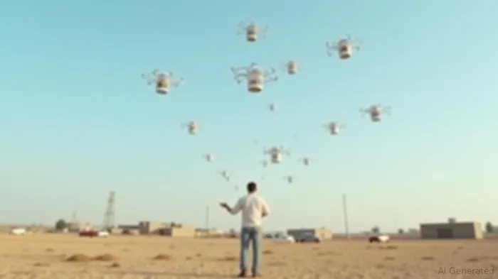
A new infrastructure layer is emerging in the skies, powered by blockchain and decentralized drone networks. This model, championed by Vancouver-based startup Spexi, is redefining Earth observation by offering faster, more scalable, and environmentally friendly alternatives to traditional satellite and manned aircraft systems. Instead of relying on centralized institutions, Spexi leverages a decentralized network of drone pilots who autonomously capture high-resolution imagery using a mobile app. These flights are verified on a blockchain, ensuring cryptographic trust in the data’s origin and accuracy.
The system operates on a fly-to-earn model, where registered pilots fly missions in predefined hexagonal zones known as “Spexigons.” These missions, which cover 25 acres each, are executed with drones below 250 grams—light enough to avoid stricter aviation regulations in most jurisdictions. Pilots receive fiat payments and build reputation scores based on verified flight data. Over 4,000 pilots have flown nearly 100,000 missions to date, covering more than 2.3 million acres across 170 cities in North America and Europe [1].
Spexi’s data is more than just imagery. Each flight generates a Proof of Capture, a hashed packet of GPS telemetry, altitude, timestamp, and image metadata recorded on-chain in real time. These verifiable records are stored on the EthereumETH-- Layer 2 Base network, enabling low-cost validation and compatibility with the broader EVM ecosystem. The images are also minted as soulbound NFTs, providing cryptographic proof of capture time, location, and elevation [1].
The company’s broader vision is to create a globally accessible, decentralized Earth imagery network. Spexi aims to serve a range of applications, including carbon markets, AI model training, insurance claims, and smart city planning. During Canada’s 2023 wildfire season, Spexi imagery was used to assess damage in emergency zones, enabling faster response times and more informed decision-making. In Los Angeles, post-fire imagery helped identify the only homes standing on entire blocks. The data is also being used to monitor urban tree canopies and river levels in British Columbia [1].
Spexi has established the LayerDrone Foundation, an independent nonprofit, to govern the LayerDrone Protocol. The foundation manages smart contracts, economic logic, and access controls, ensuring the infrastructure remains community-owned and not controlled by any single entity. Governance is expected to evolve with token-based incentives and protocol upgrades, inspired by earlier DePIN networks like Helium and Render [1].
Compliance and privacy are central to Spexi’s operations. The drones operate under strict protocols that align with most aviation regulations, and the company adheres to street-view-level privacy standards by redacting faces, license plates, and private property details. Users access the imagery via the World Viewer web app, which can render panoramic drone captures within 15 minutes of upload. APIs and developer tools are now expanding Spexi’s integration with third-party platforms and AI pipelines [1].
Spexi’s efforts are also preparing to support carbon markets, having validated a 99.7% emissions reduction compared to fixed-wing flights. The company is developing MRV (Monitoring, Reporting, Verification) tools to support reforestation and permanence tracking, ensuring that carbon offsets remain valid unless proven otherwise [1].
The rise of DePIN—Decentralized Physical Infrastructure Networks—represents a paradigm shift in how infrastructure is built and owned. Spexi is building a data layer that is fast, composable, and verifiable, enabling real-world applications that require trust in geospatial data. As climate risk, AI automation, and decentralized coordination shape the future, infrastructure must evolve beyond traditional models. Spexi’s vision is to make ultra-high-resolution Earth imagery more accessible and trustworthy, owned by the people who build and use it [1].
Source: [1] The New Infrastructure Layer Is In The Sky: Blockchain Drone Networks (https://www.forbes.com/sites/digital-assets/2025/08/18/the-new-infrastructure-layer-is-in-the-sky-blockchain-drone-networks/)
Stay ahead of the market.
Get curated U.S. market news, insights and key dates delivered to your inbox.


Comments
No comments yet